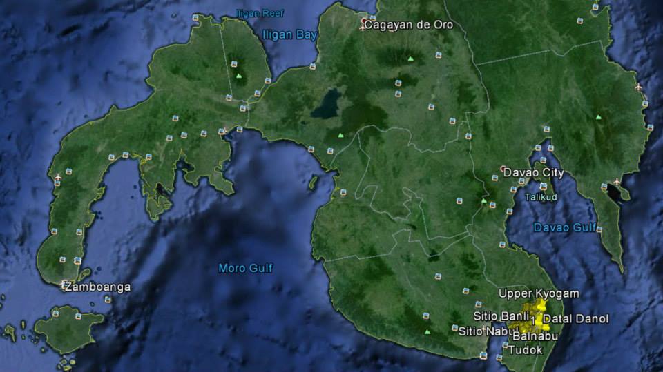

Map of our mission areas and site of the e-health centers. I gradually magnified the map to give you an idea of the distance from one site to another. - Dr. Cagape
1) This map will show the entire island of Mindanao. The yellow pins are our mission areas, located in Sarangani Province.
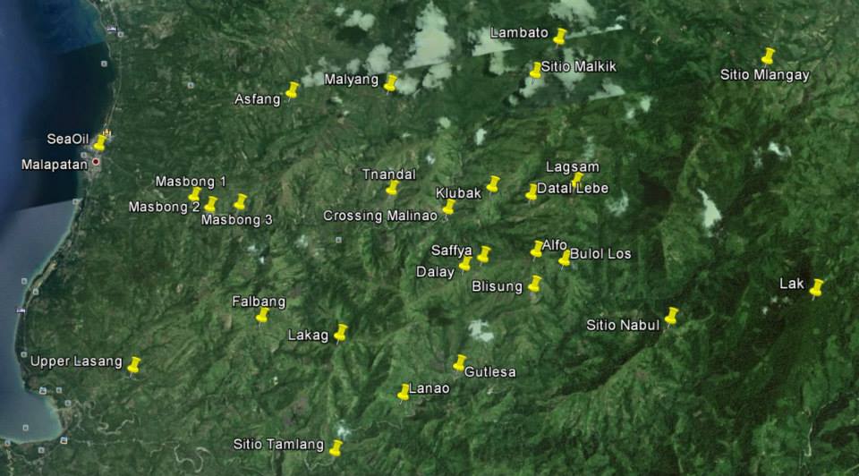
2) This map is magnified to show Gen. Santos City as point of reference. Please notice the Sea Oil located along the National Highway. This is where we start our trek up to the different mission sites following the river upstream. The crooked line on the right side of the map is a mountain range dividing Sarangani Province from Davao del Sur.
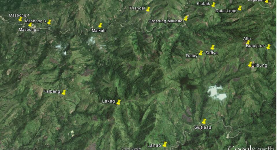
3) The map magnified further to show the distance in between sites in one barangay alone. Please notice the mountain ranges in between the yellow pins. These are the mountains we climb.
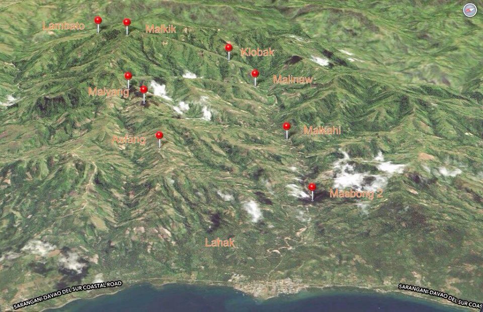
4) A magnified version of the map to show you the relative distance from one area to another. Please notice Klobak on the uppermost right, below Klobak are Crossing Malinao, Safya and Blisung. These are the sites where we constructed water system. Notice also Malkahi between Crossing Malinao and Masbong. This is where Malkahi Elementary School is located and where we constructed the dormitory for students. Malkahi to Crossing Malinao is 3 hours walk following the river upstream and to Klubak is 5 hours walk uphill. Malkahi to Safya is 3 hours walk uphill and to Blisung is 4 hours walk. The last time I was in Klubak, Crossing Malinao, Safya and Blisung was during the construction of their respective water system. I dropped 500 pieces of hollow blocks and 10 bags of cement in Masbong 1 for the foundation of their faucet. Only then shall I take pictures of each water system. However, since the start of classes, I focused my attention to the construction of dormitory and the distribution of school supplies. I expect to be back to these areas maybe August.
Henry the horse is located in Blisung while Heart is in Tamlang, below Lanao. Lanao is the elementary school without chairs is located. It is also where the teachers need a horse.
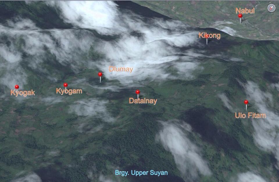
5 & 6) Other maps
1) This map will show the entire island of Mindanao. The yellow pins are our mission areas, located in Sarangani Province.
2) This map is magnified to show Gen. Santos City as point of reference. Please notice the Sea Oil located along the National Highway. This is where we start our trek up to the different mission sites following the river upstream. The crooked line on the right side of the map is a mountain range dividing Sarangani Province from Davao del Sur.
3) The map magnified further to show the distance in between sites in one barangay alone. Please notice the mountain ranges in between the yellow pins. These are the mountains we climb.
4) A magnified version of the map to show you the relative distance from one area to another. Please notice Klobak on the uppermost right, below Klobak are Crossing Malinao, Safya and Blisung. These are the sites where we constructed water system. Notice also Malkahi between Crossing Malinao and Masbong. This is where Malkahi Elementary School is located and where we constructed the dormitory for students. Malkahi to Crossing Malinao is 3 hours walk following the river upstream and to Klubak is 5 hours walk uphill. Malkahi to Safya is 3 hours walk uphill and to Blisung is 4 hours walk. The last time I was in Klubak, Crossing Malinao, Safya and Blisung was during the construction of their respective water system. I dropped 500 pieces of hollow blocks and 10 bags of cement in Masbong 1 for the foundation of their faucet. Only then shall I take pictures of each water system. However, since the start of classes, I focused my attention to the construction of dormitory and the distribution of school supplies. I expect to be back to these areas maybe August.
Henry the horse is located in Blisung while Heart is in Tamlang, below Lanao. Lanao is the elementary school without chairs is located. It is also where the teachers need a horse.
5 & 6) Other maps
 RSS Feed